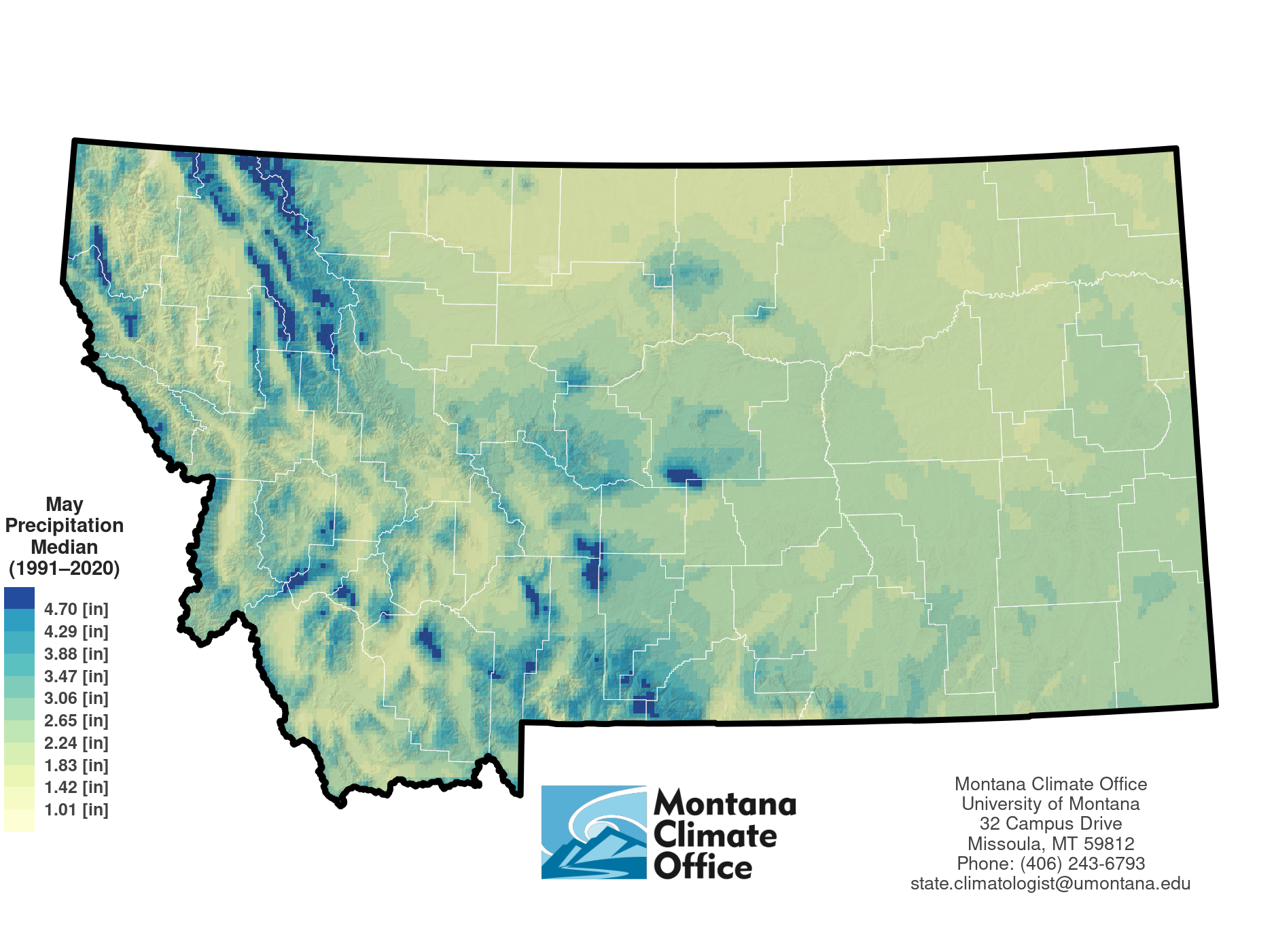
The Montana Climate Atlas
The Montana Climate Atlas is a compendium of climate normals for the 1991 - 2020 period. A variety of resources including an interactive atlas exporer, premade maps of climate normals are linked below:
**A Cloud Optimized GeoTIFF (COG) is a regular GeoTIFF file, aimed at being hosted on a HTTP file server, with an internal organization that enables more efficient workflows on the cloud. It does this by leveraging the ability of clients issuing HTTP GET range requests to ask for just the parts of a file they need.
Motivation
Montana benefits from a mix of maritime and continental climates that generate a high-quality water supply. We rely on that water supply. It grows our food, supports our recreation, and provides for our industries and communities. Climate variability can foster uncertainty about local water availability. Coupled with increased water demands, this underscores the need to better understand trends in Montana’s climate as how it varies over time and geographically. By leveraging existing information we can advance our understanding of Montana’s climate and how it contributes to sustaining livelihoods.
The Montana Climate Office produced the Climate Atlas of Montana to spark a conversation about how climate relates to the resources and industries we depend upon. As a living document, this collection of maps characterizes just a portion of what is understood about Montana’s climate. Perhaps it will provide some with a better understanding of “The Last Best Place.” It may inspire one to question and offer new insights into the complexities of our climate. The Climate Office welcomes your insights, questions, and participation.