Disastrous Windstorm Across Montana’s Hi-Line Impacts Producers
A powerful windstorm swept across northern Montana’s Hi-Line region on May 14, 2026, producing widespread damaging winds, severe blowing dust, and extensive impacts to agricultural lands across the region. Montana Mesonet weather station observations documented sustained strong winds and damaging gusts extending from north-central Montana eastward to the North Dakota border. High winds were experienced across the state, with many stations reporting gusts over 70 miles per hour and capable of transporting large amounts of topsoil.
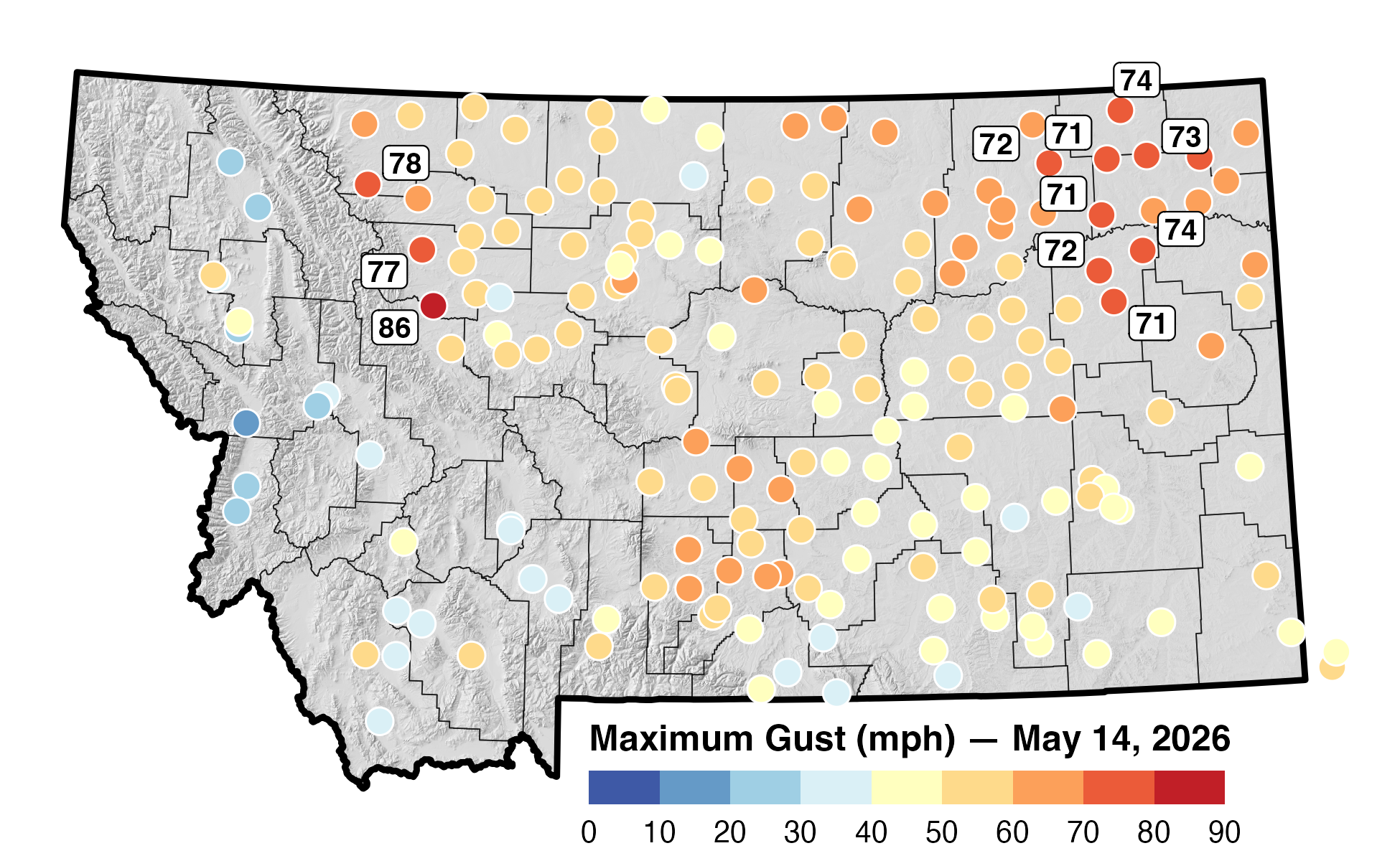
The storm affected a large portion of Montana’s dryland farming region, further desiccating a landscape already experiencing moderate (D1) to severe (D2) drought conditions, and at a particularly vulnerable time of year for producers. Many producers were in the process of seeding operations, with fields exposed to hurricane force winds. Across portions of the Hi-Line and northeast Montana, winds lifted loose soil into the atmosphere, creating widespread dust plumes that reduced visibility and transported valuable topsoil away from agricultural fields. In several areas, blowing dust became dense enough to resemble brownout conditions, significantly impacting local travel and field operations.
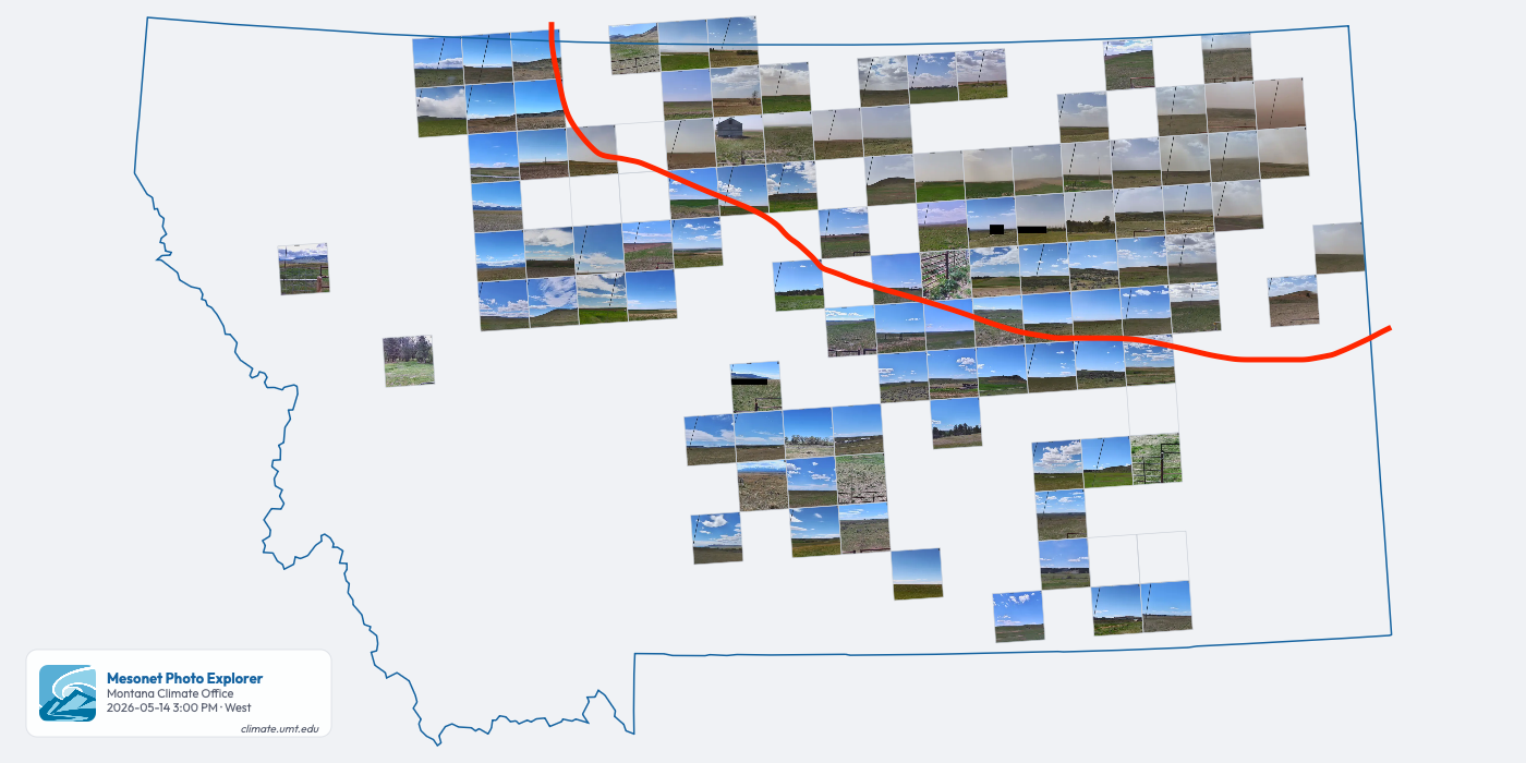
Montana Mesonet stations are equipped with cameras that allow us to visualize the extent of the impacts. Numerous camera sites across the region captured large dust clouds moving across open farmland, with visibility rapidly deteriorating as soil particles became airborne.
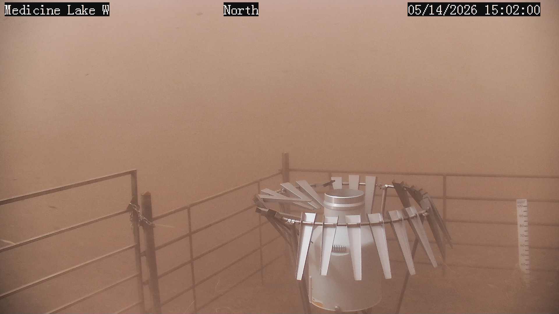
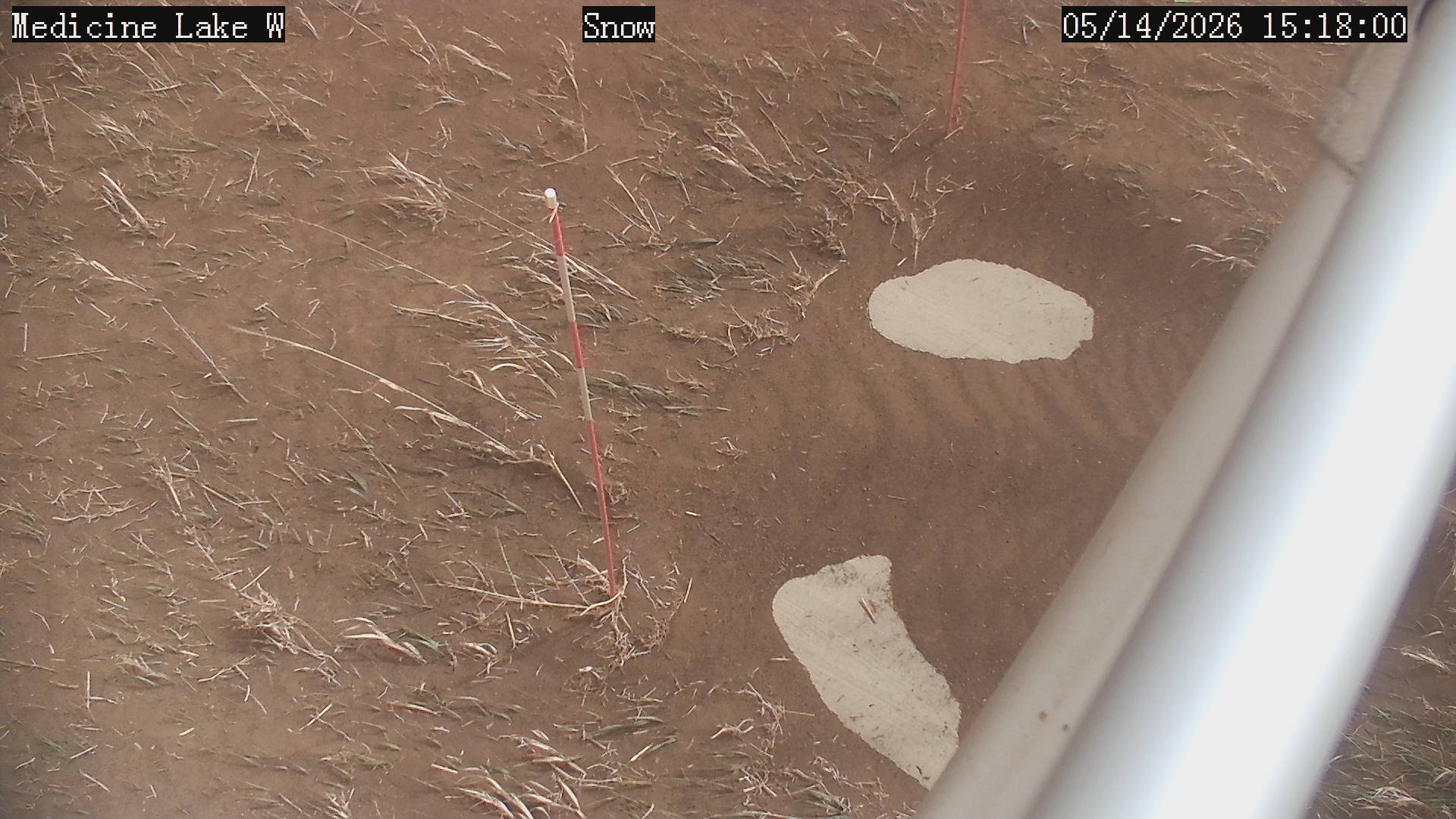
The Medicine Lake weather station near Plentywood images provide a local example of the storm’s intensity, showing near-zero visibility conditions caused by blowing dust and almost an inch of wind-blown topsoil accumulated near the stations base.
Agricultural impacts from the storm are likely to be substantial. Recently planted fields experienced severe wind erosion as dry surface soils were stripped and transported downwind. In many locations, producers will suffer loss of planted seed, exposure of seed rows, and further movement of wind-blown soil that is sufficient to bury any emerging crops.
Beyond the immediate impacts to emerging crops and field conditions, this storm may create longer-term challenges for producers already managing through drought conditions. The loss of nutrient-rich topsoil threatens productivity by reducing water infiltration, degrading soil health, and increasing vulnerability to future erosion events. Repeated wind erosion events of this magnitude can diminish crop resilience, reduce yield potential, and place additional financial strain on producers.
Overall, the May 14 windstorm represented one of the more significant regional blowing dust events observed in recent years across the Hi-Line. The combination of high winds and dry soils created conditions favorable for widespread erosion and agricultural impacts across a large portion of the state.